The angled line to the right is the Treaty of Greenville line which delineated the western boundary of the land the Indians ceded to the United States. The line crosses the National Road (US 40) near present day Salisbury Road. The Daughters of the American Revolution placed a marker there in 1924, and it can still be seen in front of McDonald's. This line exists today in the angle of Boundary Road near Fountain City and on Flatley Road between Webster and Tingler Roads.
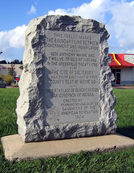
This tablet
marks
the boundary line between
Government and Indian lands
fixed by
Gen. Anthony Wayne and
twelve tribes of Indians
in the Greenville Treaty, 1795.
Also
the site of Salisbury
1/3 mile south east – the first
County Seat of Wayne Co.
also
the birth place of Oliver P. Morton
War governor of Indiana
Erected by
Richmond, Indiana Chapter
Daughters of the
American Revolution
1924.
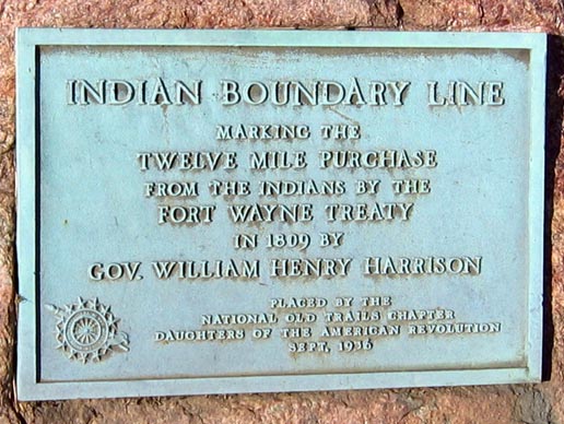
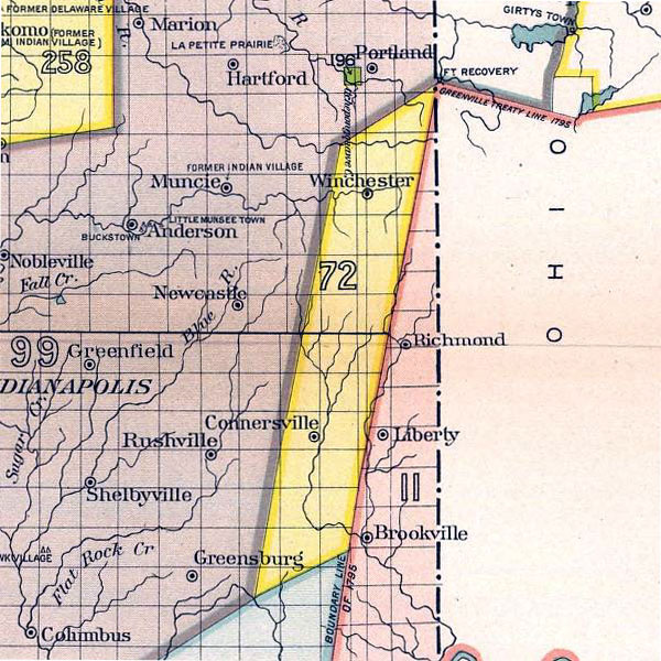
Twelve Mile Purchase
In 1809, the settlers bought from the Indians a strip of land, shown above in yellow, whose western boundary was parallel to the Greenville Treaty line. Because the line was 12 miles west, the area became known as the Twelve Mile Purchase. This line crossed the National Road in the western part of Cambridge City, and is present in Treaty Line Road south of Hagerstown.